|
Features:
This incredible hike follows the Wonderland Trail and for an in and out one day hike, it is extreme. Even as an overnight hike, it is very difficult
due to the mileage and elevation gain. The high point on the tail for this hike is 6782 feet above sea level, so obvioulsy, this is a mid summer early
fall hike.
Most hikers begin this adventure at the Fryingpan Creek parking area and connect with the Wonderland Trail.
For the first mile and a half the trail is wide and quite gentle. Then there are a couple of switchbacks that take you to the
edge of Fryingpan Creek. After these switchbacks the trail becomes narrower and climbs a bit steeper until you reach the
bridge that crosses Fryingpan Creek. Until you reach the bridge, this hike is mostly in a densely forested environment.
 After crossing Fryingpan Creek, the trail is more in the open and in season, the wildflower displays are absolutely amazing.
Soon the trail begins to climb through a set of switchbacks that columinate in an area known as Summerland. Summerland has
toilet facilities and several designated camp spots.
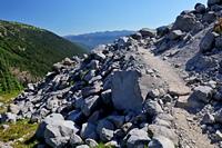
 After Summerland, the trail travels though a very rocky area. Soon it crosses a significant stream which usually has a
log crossing, depending on the flow of the stream. After crossing this creek, the trail climbs more steeply until it
comes to a beautiful little lake, or tarn.
After the lake, the trail continues to climb and most of the year, it crosses significant snow fields. Use caustion while
crossing these, as melt streams beneath them can weaken the surface and you could fall through. At approximately 5.5 miles
into this hike, you will arrive at Panhandle Gap. The views as you approach the gap are absolutely world class.
In front of you is Mt. Rainier at 14,410 feet in elevation, and right in front and just to the left is Little Tahoma at
11,138 feet in elevation, and just in front of it is Whitman Crest a about 9,330 feet in elevation, and right in front of
you is a ridgeline that is about 7,228 feet in elevation.
After crossing Panhandle Gap, the trail begins its descent into the Ohanapecosh River valley where Indian Bar is located.
Again, there are usually a number of snow fields to cross and the trail is way above timber line. The views along this
portion of the hike are world class just about any direction you look. To the south is the magificant Goat Rocks, and
behind them is Mt. Adams. To the east is the Cowlitz formations, including the Chimney.
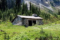
 As the trail descends into the Ohanapocosh River valley, you will be able to see the Indian Bar trail shelter. This is
a sturdy structure and can be used to overnight and/or get away from inclimate weather. There is a sturdy little
bridge over the river just before the cutoff trail to the shelter.

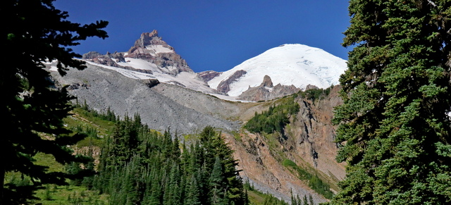
Mt. Rainier from the Wonderland trail near Summerland Camp
|
