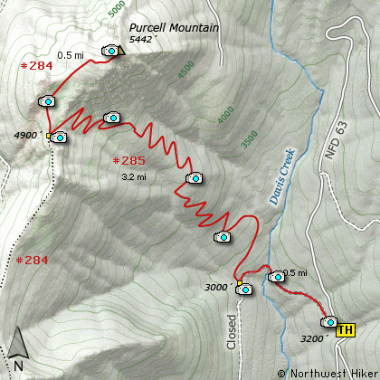
Length: 8.4 Miles round trip
Elevation Change: 2640' Elevation gain
Season: Summer thru Fall
Difficulty: Difficult
Permit: No Pass Requirement
Features:
This hike begins where Forest Road 6300.057 leaves FR 63. Due to a washout
this road to the trail head is unusable, so it has been bermed right at the
beginning. Therefore there is only room for 1 vehicle to park at the existing
trail head.
The trail follows the road downhill a bit until it crosses the washed out area
where the road used to cross a small stream. This stream could be difficult
to cross if the water is high. On the summer day I crossed the stream, as you
can see in the photos, the crossing was very easy.
After the stream, the trail begins to slowly climb until you come to the sign
announcing Trail #284 to Purcell Mtn. Now things get serious. The
trail becomes steeper and steeper as you begin the climb up Purcell Mountain.
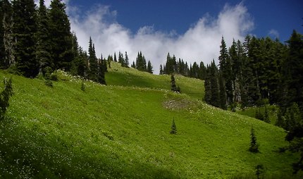
In season you will begin to enjoy a large variety of wildflowers.
The trail has many switchbacks which make the steep climb quite tolerable.
At about 2 miles you will break out into open areas with fantastic views. At
2.5 miles you will intersect the Purcell Mtn Trail #284. Now you follow the
ridge line to the summit through fields of wildflowers in season.
The views from the summit are worth every bead of sweat it took to get there!
Purcell Mountain trail
|