How to get there:
NEW!
Click for PDF Directions Map of this Hike
From Portland, OR
From Portland, travel east on Interstate Hwy 84 to Exit 64 at Hood River.
Turn left, and pass under the freeway and cross the toll bridge ($2.00)
into Washington state. Turn left onto SR14 and drive approximately 1.5
miles to state road 141 Alt. Turn right onto SR141 Alt. and follow it another
2 miles and merge bearing left onto SR141. Then travel north on SR141
for another 19 miles to Trout Lake and the junction to Mt. Adams Road,
which heads north to other hike destinations.
from Trout Lake, WA
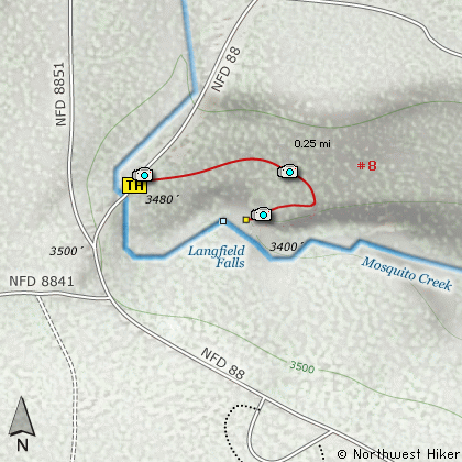
Bear left and continue on SR141 for another 1.7 miles where you will
come to Trout Creek Road, which is also Forest Road 88 on your right.
Turn right onto FR88 and follow it north-northwest for about 3.9 miles
and you will come to Forest Road 010. Bear to the left and stay on
FR88. In about 8.6 miles you will come to a series of intersections,
but just continue on FR88 as it bends to the right and crosses over
Mosquito Creek. You will pass FR8841 on your left, then FR8851, also
on your left. Just continue ahead on FR88.
The trailhead and parking area for Langfield falls will be on your right.
|