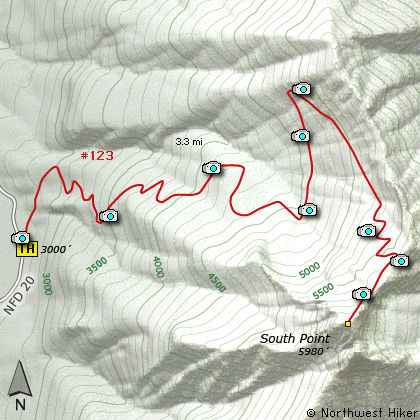
Length: 6.6 Miles round trip
Elevation Change: 2980' Elevation gain
Season: Mid-Summer thru Fall
Difficulty: Difficult
Permit: No Pass Requirement
Features:
This hike begins on Forest Road #20. Keep in mind
that this hike climbs nearly 3000' in about 3 miles.
Therefore, the trail begins its steep ascent
immediately. Almost all of this hike is in dense
forest.
Much of the trail actually follows old logging
roads as it makes its way up South Point Mountain.
Not until about 2.5 miles and 2000' of elevation
do you get any respectable views. At that point
you also get great floral displays in season.
Over the next mile you get to climb the last
1000 feet and it is not until the end that you
get your reward. And what a reward you get!
This mountain is so steep and the top is so
precarious that it is almost like being in
an airplane. Be aware that you might encounter
snow, even in late July. I didn't make it
the last 300 feet because of the snow. The
snow was hard and very very steep, so I didn't
climb it to the top.
But I did get a photo of a life time, so it
was worth it.
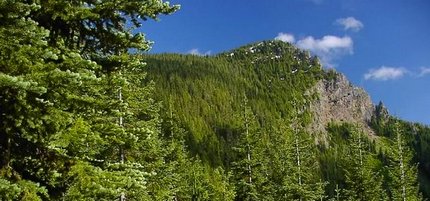
Southpoint Mountain
|