Length: 11.4 miles round trip
Elevation Change: 3840' gain
Season: Midsummer
thru Fall
Difficulty: Very Difficult due to steepness of trail and length of hike
Permit: NW Forest Pass Required
Features:
NEW!
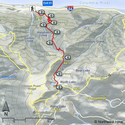
Click for PDF Topo Map of this Hike
This is an excellent hike for endurance. Yet, it is also an excellent adventure hike.
The trail begins at the Wyeth Campground trailhead. Just follow the main trail out of
the parking area for a short distance, until it comes to a junction with Gorge Trail #400.
Make a sharp left at this point and continue on Trail #411.
You will have to cross a major stream within a short distance, and depending on the time
of year, this could be a bit of a challenge. After crossing the stream, the trail wanders
for just a bit before picking up steam and starting the incredible 1000 feet per mile ascent
up Wyeth Ridge.
After climbing 3840' in the first four miles, you then keep left and descend 500 ft before regaining the elevation as you
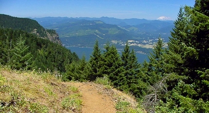
approach North Lake. The climb up the Wyeth Trail offers excellent
vistas of the Columbia River Gorge. North Lake is a shallow little
lake surrounded by forests and the cliffs of Green Point Ridge.
However, bear left and continue slightly downhill for another half mile where you will break
out into an open area with excellent views of Mt. Defiance to the east. Continue another
quarter mile and then climb up to the edge of North Lake.... a great reward on a summer day.
 Wyeth trail to North Lake
|