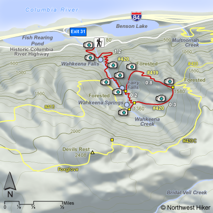
Length: 3.7 miles round trip loop
Elevation Change: 1500'
Season: Year Round
Difficulty: Challenging due to steep climb
Permit: Not Required
Features:
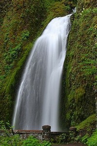 Moderate climb to base of falls then a steep climb to an overlook
of the Columbia River Gorge. The trail continues up a steep grade to Fairy Falls,
then loops back onto itself.
Moderate climb to base of falls then a steep climb to an overlook
of the Columbia River Gorge. The trail continues up a steep grade to Fairy Falls,
then loops back onto itself.
Except for the overlook, the entire hike is in densely forested areas.
The trail begins as a paved path, but becomes the typical earth and
stone trail for the majority of the hike. During wet times the path
can get muddy and slick.
In season, like all the gorge trails, you can expect spectacular
wildflower displays which vary as spring turns to summer turns to fall.
|
|
How to get there:
From I-84 take Exit #31/Multnomah Falls. Park in the parking lot and walk under
the footbridge to Multnomah Falls Lodge.
Alternatively, take I-84 east to Exit #28/Bridal Veil and drive east on the
Historic Columbia River Highway to the Multnomah Falls Lodge parking area.
Coming from the east on I-84, take exit 35 (Ainsworth Park) and drive about 5 miles west on the
Historic Highway (pass Multnomah Falls) to reach the Wahkeena Falls parking area and trailhead.
|