Length: 2.25 miles from Trail Head to Trail Head
Elevation Change: 50' gain
Season: Year Round
Difficulty: Easy
Permit: No NW Permit, But you must pay a fee to enter the park
GPS: N45 32.807 W122 14.124
Features:
NEW!
Click for PDF Topo Map of this Hike
This hike begins and ends in a
parking lot. The trail runs the length of the Rooster Rock
State Park to the east and returns by a loop. There is very
little elevation change, and very limited views. Please note
that the area along the trail on the banks of the Columbia River is
designated a " nude beach " area. Also, in spring and summer be very
careful for the stinging nettle along the trail!
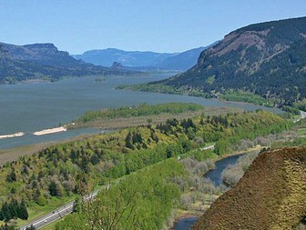
 Columbia River Gorge from Crown Point
|